Sunday, August 24, 2014

Sunset Trail - Mt. Eldon - Flagstaff, AZ August 9, 2014


Sunset Trail Head

What better way to start off a Saturday in the cool pines of Flagstaff after a great breakfast at Miz Zip's Cafe on Route 66 than to take in the beauty with a hike.  So after looking at the hiking trail map we decided that Sunset Trail would be the hike for the day.  Temperatures were perfect for hiking and it was a bit cloudy which was even better.  The road to the Trail Head is just off of Route 66 and Schultz Pass Rd which is a dirt road with some wash board areas so take it slow and hopefully you have a truck that can handle this type of area better than a car.  

The parking area is clearly marked and there are rest room facilities at this trail head.  This trail is easy to find and is a nice trail with very little rock and a gentle incline that is easy to maneuver, just keep in mind the elevation difference that we valley dwellers are not typically used and thinner air.  We met a lot of mountain bikers on this trail so be mindful of that as they can appear out of nowhere at times.  First stop was at Schultz Tank a pond like body of water with a back drop of the mountains.  A really amazing view.  


Then we continued onto the Sunset Trail to make our way to the lookout point.


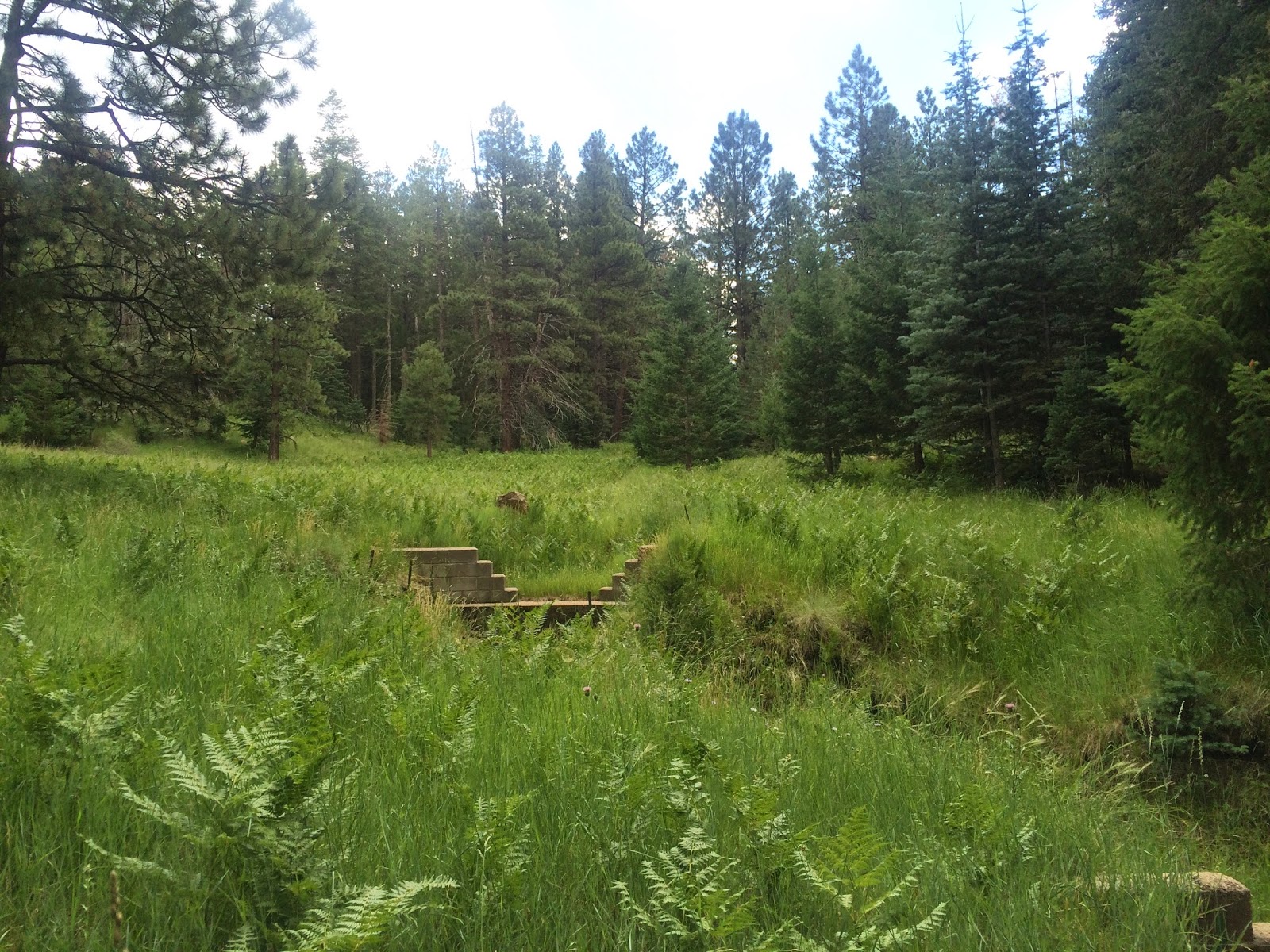
Sometimes I think we forget about all the beauty that Arizona offers us and that we have this amazing forest area just a few hours away.  It was great to see how green everything was and that there was a low fire danger since they have been getting plenty of rain this year.  Here are a few pictures along the trail.


As you can see lots of green everywhere.  It was also nice to see the younger trees that were growing since the Schultz fire of 2010 in this area.  Once at the top here was our view:


So peaceful and serene the only sounds were the wind through the pines and the low rumbling of thunder.  A great place to clear your mind and rejuvenate your body, mind & soul that is for sure.  You can see in the photos where the Schultz fire had destroyed the trees.  

Round trip hiking miles approx. 5 miles.  This is a great hike and one I would definitely take again.    


Thursday, August 21, 2014

Fossil Springs Hike - Strawberry Arizona - July 12, 2014


So after reading about Fossil Springs in our company newsletter and some articles about it on other hiking sites I thought this is a place I need to see.  So typically hiking in July in Arizona you head North not only for cooler temperatures but also to enjoy the green that hopefully awaits.  

My hiking partner and I left the valley at 6:30 AM and made the drive North to Payson where we stopped for breakfast before we made the 4 mile hike down to Fossil Springs.

Once at the trail head we were met by two Park Rangers which wanted to reiterate to us that we would need plenty of water and also the fact that it was 4 miles downhill to the Springs and then 4 miles back to the Trail head.  We gave them a confident Yes!  We were prepared and ready to tackle the trail before us.  The first mile was relatively flat and just normal trail grit type of trail surface.  Then the real challenges began to show themselves.  Long paths of medium to large sized rocks on a downhill grade that makes you wonder how long is this going to last?  Well it lasted about 2-1/2 miles with small breaks in between of smoother trail.  But we were not going to be deterred from completing the hike to see the Springs.  Even though I had some major blisters I couldn't wait to get my feet into the cool water that I knew was awaiting ahead.  Fortunately for me I had a hiking partner that comes prepared for almost anything so band aids on the toes and we were off to seek the water.  It was a much warmer day than what we were hoping for but we managed to endure the heat and carry on.  Frequent breaks in the shade to cool down and rest the feet from the rocky trail.

Crossing the dry spring bed of rock and then a short walk in some tall grass and we could hear the springs.  Down the bank and there it was running quickly and many people in the Springs swimming and dogs swimming too.  It was so beautiful and off with the boots to soothe our tired feet.  Awwww…. so very nice.


We enjoyed the cool water of the Springs and the soothing sound of the rushing water for a couple hours and then we knew it was time to make the trek out.  So boots back on and away we went.  Needless to say, at least for me, the hike out was pretty treacherous.  Not wanting to fall and get an injury was at the top of my list so slow and steady was the plan.  We headed on our way out around 4:30 PM and reached the trail head parking lot at 8:30 PM.  Caught a light rain shower on the way out which was very refreshing and used the headlamp to light the last part as it was very dark with the cloud cover.  Overall a great hike but definitely not for the faint of heart.  Probably best to hike this in the early Spring or late Fall when the temperatures are more pleasant.  Definitely make sure you take plenty of water and are prepared for a rocky trail and a steep climb back out.  


Monday, February 21, 2011

Lost Dog Wash Trail - McDowell Mtn. Park - North Scottsdale

February 21, 2011

Located off Via Linda & 124th Street

Finally the rain has left the area and the sun was shining brightly - time for a hike!  This trail is approximately 4.5 miles round trip.  I would consider it an intermediate hike compared to other trails I have hiked in and around the valley.  We hiked to the Taliesin Outlook where we could look out over the valley and I think I could see Mt. Humphrey as I saw a mountain with a lot of snow in that direction.  No one in the group could confirm or deny my sighting..... The terrain is smooth in most areas and rocky in others.  So good hiking footwear is a must and make sure you have at least 2 liters of water with you.  I actually took my first fall today by not picking my foot up high enough.  Just a couple of skinned knees however I had to slow down a bit.  All in all a very nice hike and I would definitely hike this trail again. Dogs are allowed on this trail but must be on a leash.  There is also water & restrooms at the trail head.


Desert Beauty in Arizona

Meet Up Hiking Group

Arizona Cactus

View from the top

View along the trail - awesome!

Sunday, February 20, 2011

Desert Classic Trail - South Mtn. Park

 February 6, 2011

This was a day that I took my grandson Collin and my daughter Lindsay to explore a new trail.  The Desert Classic is a very smooth and level trail for the beginner which Collin being 3 years old is a new to hiking.  He did very well and hiked further on this day than his first outing.  We got to see some wildlife on this outing.  Bunnies, lizards and some cactus wrens.  There are quite a few mountain bikers & runners on this trail. If you are looking for a trail for little hikers just starting out I would highly recommend this one.  The trail head is just off of Chandler Blvd. 


Trail Marker

Collin setting the pace!

The mighty Saguaros.


The Desert Classic Trail
Turn Around Point

Pinnacle Peak - North Scottsdale

February 5, 2011

Carrie & I set our sites on this hiking location on another wonderful Arizona winter day.  This trail is heavily traveled by all kinds of hikers/runners.  It is not a loop trail so you hike to the end then turn around and hike back for a total of 3.5 miles.  It took us 2 hours 15 minutes.  The trail is very smooth and well maintained.  Lots of beautiful scenery to look at on this trail.  You can see Troon Golf Course, some really amazing multi-million dollar homes and of course the natural habitat of the trail/mountain.  Make sure you pace yourself on this trail as going in is easier than hiking out.  Save some energy as you will need it for those switchbacks that your hiked down on the way out.  There are a couple of wonderful lookout points that point out the surrounding mountains throughout the valley.  I highly recommend this trail to the novice/beginner hiker as a great way to break into the world of hiking.  Have fun and be safe!


Telegraph Pass Trail - South Mtn. Park

January 8, 2011

Hiked Telegraph Pass today and it was another beautiful day to be out hiking.  The trail was pretty busy on this day as it should be with the great Arizona sunshine providing just the right temperature to be out hiking.  My friend Carrie and I hiked this trail then went on up to the lookout point to take in the view of downtown and Ahwatukee/Chandler.  We followed a paraglider up to the lookout point and he continued on up the mountain for his descent.  I highly recommend this trail for intermediate to experienced hikers.  There are a lot of high step ups near the top of the trail making your heart rate increase. 

Here is a picture of Carrie & me at the look out point.

Carrie & I at the top of South Mtn. Lookout Point

Paraglider  - South Mtn.

Tuesday, November 30, 2010

Squaw Peak Hike

Sunday, November 28, 2010

This particular mountain had done me in during the summer months and I really didn't get very far so on this day I was determined I would tackle the beast and get to the top!

The terrain starts off rather smooth and soon it becomes a challenge.  Luckily for me my new hiking boots proved to me to not worry that they would be there for me assuring me sure footing and ankle support.

A lot of this trail is like walking on the points of rocks with few flat spots to place your foot so it is not an easy path to tackle.  But as you progress you will gain confidence in your footing and ability to tackle this type of terrain.

For me it meant keeping hydrated even though it was a rather cool day in the low 60's with a lot of wind.  For these types of temperatures it would be easy to think you wouldn't need as much hydration but I caution you to bring enough water or Gatorade to keep you well hydrated.  If you are one that requires an energy boost after an hour or so of hiking be sure to bring a snack to replenish that energy source. 

Slow and steady is the pace I chose on this day even though many people running/sprinting up the mountain passed us and made it look so easy.  I know that in order for me to be successful I had to pace myself as this is not an easy trail for most.  Lots of high step ups and rocky areas and I didn't want to fall or get injured in any way.

So my hiking partner Dan let me lead the way and told me right out the gate pace yourself you have a long way to go and he was right.  It's 1.2 miles to the summit of this mountain.

Some points of interest - this is the most popular hiking area in the United States.  There are between 4,000 to 10,000 hikers per week on this trail.  So it's always pretty busy you have to get there early to ensure a parking spot.  The Army Corp of Engineers helped create the trail and I must say all those steps - great job!  The Summit Trail is 1.2 Miles one way and the elevation climbs up to 2,608 feet from a starting elevation of 1,400 feet.  You will gain more than 1,200 feet in elevation on this hike.  This particular trail is rated Strenuous and Difficult.  I totally agree with this assessment!  

There are rest spots with benches along the way and I encourage you to take advantage of them and give your legs and feet a break.  The last few turns of the trail are probably the hardest with lots of little steps so you will feel like you have been on a stair climber just when you are running out of energy.  Then there is a massive boulder with crevices that you have to maneuver to actually reach the top.  The view that awaits you and the feeling of satisfaction knowing that you made it to the top is amazing.

Like I said before there are many people that hike this trail daily and some multiple times.  On this day we spoke to a very young man that was on his 4th trip up for the day.  He didn't have an ounce of fat on his body.  He was running in converse tennis shoes and was moving with the ease and agility of a cat leaping and jumping from one rock to another all the while carrying his gallon jug of water in one hand.  God Bless him!  Oh to be young again.  

This is definitely the most difficult hike for me to date and a great training site for preparing for the Canyon hike in March. 
Happy hiking everyone!